

Rough Cilicia Archaeological Survey Project, 1996-2011
Abstract
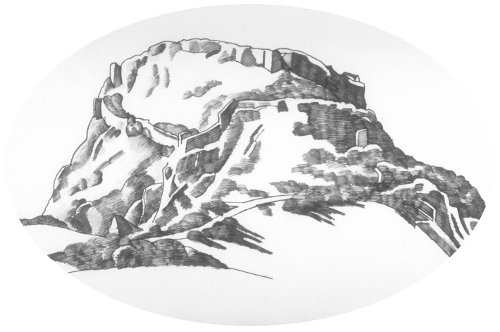
The 2008 season of the Rough Cilicia Archaeological Survey Project was conducted between July 18 and August 5, 2008. The research agenda of the 2008 season consisted of off-site pedestrian survey in the highland canyon of the Biçkici River, more specifically, the terraced agricultural terrain in the village of Karatepe. The scattered communities (mahalleler) of Karatepe extend along the lower slopes of the semicircular canyon (approximately 8 km across) that encloses the Biçkici watershed. At Sugozu Yayla the crest of the canyon stands at 1700m above sea level (asl). At the base of canyon lies a long flat alluvial terrace, 500m asl, that is dissected into a peculiar V-shaped landmass by the two branches of the river. Small neighborhoods such as Kaynarca, Akkaya, and Sugozu are nestled in the sloping terrain surrounding this central terrace between 800 and 400m asl. This unusual landscape has been a source of interest to the project since 2000. It was the intention of the project director to investigate some portion of the terrain this season to better understand patterns of land use in this highland basin during antiquity.
Keywords
Ancient Greece, archaeological survey, pottery, Turkey
DOI
10.5703/1288284316874
Date of this Version
1-10-2019
Recommended Citation
Rauh, Nicholas K., "Rough Cilicia Archaeological Survey: Report of the 2008 Season" (2019). Rough Cilicia Archaeological Survey Project, 1996-2011. Paper 14.
http://dx.doi.org/10.5703/1288284316874