Indiana Mobility Reports
Recommended Citation
Sakhare, R. S., Li, H., Mathew, J. K., Desai, J., Horton, D., & Bullock, D. M. (2022). Indiana interstate speed profiles 2018–2022. West Lafayette, IN: Purdue University. https://doi.org/10.5703/1288284317589
DOI
10.5703/1288284317589
Abstract
Systemwide interstate performance measures that detail hours and location of congestion on an interstate provide important information for decision makers to plan capital projects and assess operations. This report presents summary of mile-hours of congestion across 8 Indiana interstates and the Indiana toll road.
Hours of operation by speed bins (0 to 14 mph, 15 mph to 24 mph, 25 mph to 34 mph, 35 mph to 44 mph, 45 mph to 54 mph, 55 mph to 64 mph, more than 65 mph) for every 0.1 mile of the interstates across a month were tabulated for every hour of every day during the month. The quantities of those six different speed bins are plotted as a stacked bar plot from lower to higher speeds by mile marker for each month. The vertical axis shows the mile marker of the interstate. Horizontally, these stacked bars are cropped at maximum of 250 hours (a little more than 10 days) per month to focus on the lower speeds.
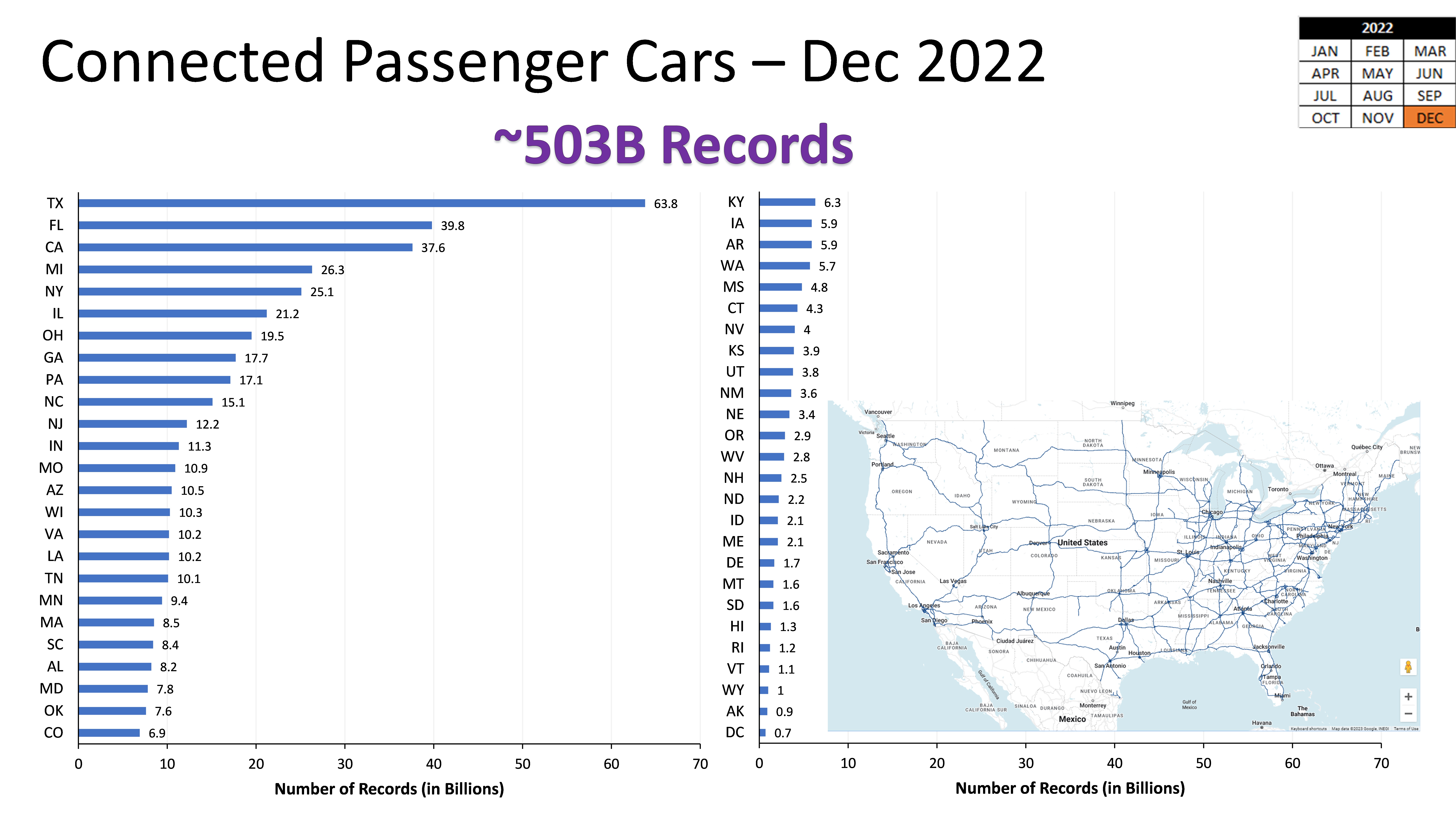
To produce these plots, approximately 60 billion records from INRIX across 5 years were analyzed. These speed profiles help identify areas with congestion at system level as well as regions impacted by severe winter storms and construction projects.
Keywords
interstate traffic, congestion, traffic hotspots, system level analysis, big data
Date of this Version
2022
Version
Full Version

